This project marked the first time we deployed drone technology for land surveying—and the first such application in the region—allowing us to document highly complex and hazardous conditions around Fort Oranje on St. Eustatius that would have been impossible to capture using conventional methods.
At the height of its prosperity as one of the most important transshipment hubs in the Caribbean, the island of St. Eustatius earned the nickname “The Golden Rock.” While the name reflects the island’s commercial success, the image of a rock can be misleading. A rock suggests permanence, strength, and invulnerability—qualities that history and geology show do not apply here.

St. Eustatius has changed hands multiple times with relative ease, and the idea of indestructibility is even more misplaced. As early as the 17th century, risks associated with building on the island’s cliffs were already apparent. When the original Dutch fort was expanded after 1636 into what would become Fort Oranje, erosion along the cliff edge proved problematic. Heavy rainfall repeatedly washed away soil, and by the early 18th century, one of the bastions had already collapsed down the cliff
(J.H. Hartog, De Forten, verdedigingswerken en geschutstellingen van St. Eustatius en Saba).
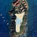
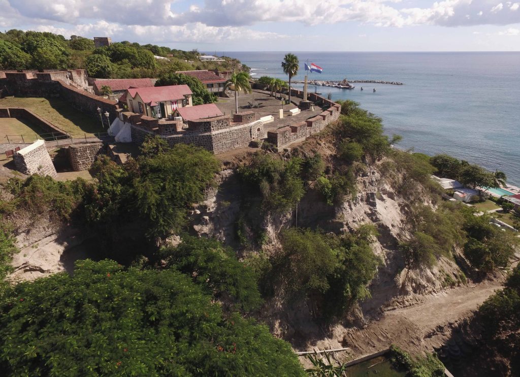
The island’s perimeter consists largely of volcanic debris deposited by ancient eruptions: loose, coarse stones bound together by relatively soft tuff (compacted volcanic ash). From the sea, this gives the appearance of a solid rock mass—an impression that likely influenced the historical decision to locate forts and artillery positions along the island’s edge. Fort Oranje occupies a prominent position on the western side of the island, partly founded on a projecting cliff.
Geologist J.H. Westerman describes how, after volcanic activity subsided, erosion processes gradually took over. Rainwater and wave action removed loose material, accelerating cliff retreat, a process still clearly observable on St. Eustatius and Saba today (The Geological History of the Windward Islands, 1957). Without renewed volcanic activity or geological change, these islands will continue to erode over geological time.

This long-term process is not merely theoretical. It reflects the current condition of St. Eustatius. The possibility that Fort Oranje could partially or entirely collapse in the foreseeable future is therefore not unrealistic. This threat has had to be addressed before. Reporting on restoration works in 1998, the Dutch newspaper Trouw wrote: “At the same time, the cliffs on which the fort stands are being reinforced. Due to erosion, they threaten to crumble, which could cause the entire fort to tumble into the sea.”
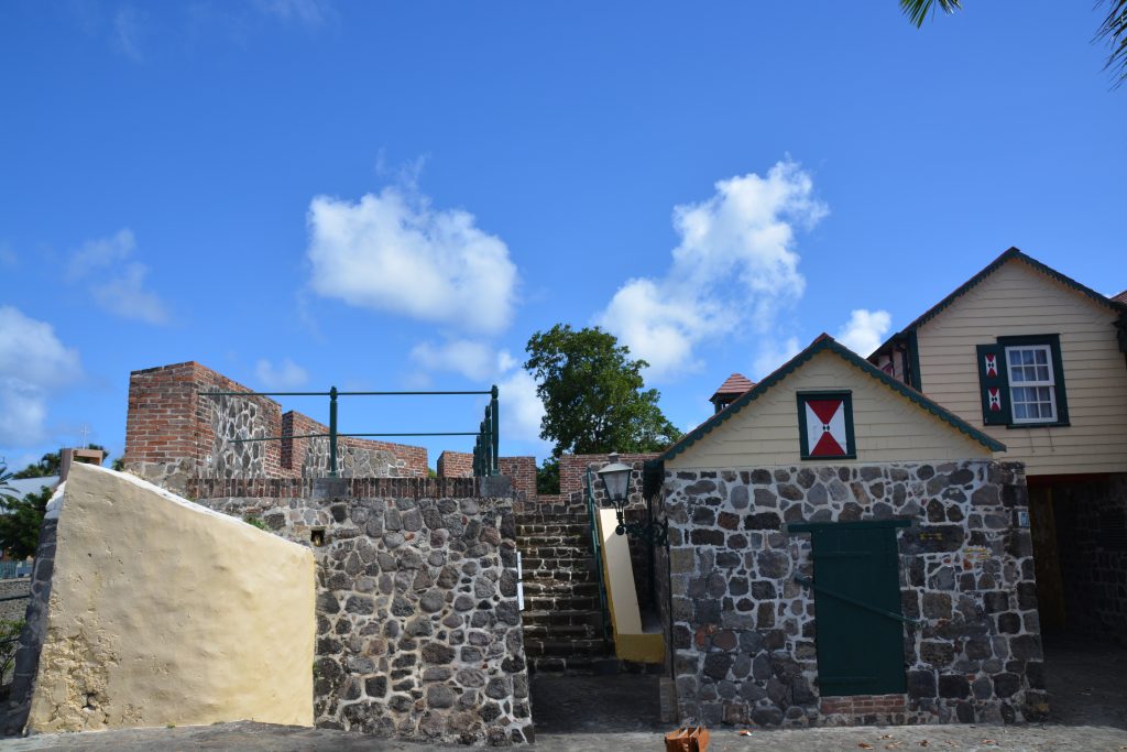
Climate, Maintenance, and Material Decay, the destructive influence of climate on a Windward Island like St. Eustatius should not be underestimated. Of the many forts and defensive structures once present on the island, very little remains today. Fort Oranje is the sole survivor, largely due to its continuous use as a governmental center and the consistent attention paid to its expansion, maintenance, and choice of materials.
However, this survival is not guaranteed. Without ongoing, high-quality maintenance, Fort Oranje is vulnerable to rapid deterioration. Restoration works carried out approximately fifteen years ago already show significant decline today, underscoring the urgent need for a renewed conservation strategy.
Lessons from Fort Amsterdam, St. Maarten, the impact of natural forces on a fort’s most critical defensive element—the parapet—can be clearly illustrated by the recent condition of Fort Amsterdam on St. Maarten. There, erosion caused the parapet to lean forward and approach collapse. This process accelerated dramatically in recent years.
An emergency stabilization project executed in 2016 prevented irreversible loss. Fort Amsterdam is now structurally stabilized, providing a foundation for possible future revitalization. The initiative, planning, and execution of this emergency intervention were led by DAM Caribbean. This project serves as a valuable precedent and technical reference for our research and advisory work on Fort Oranje.

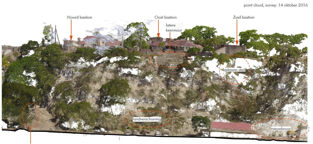

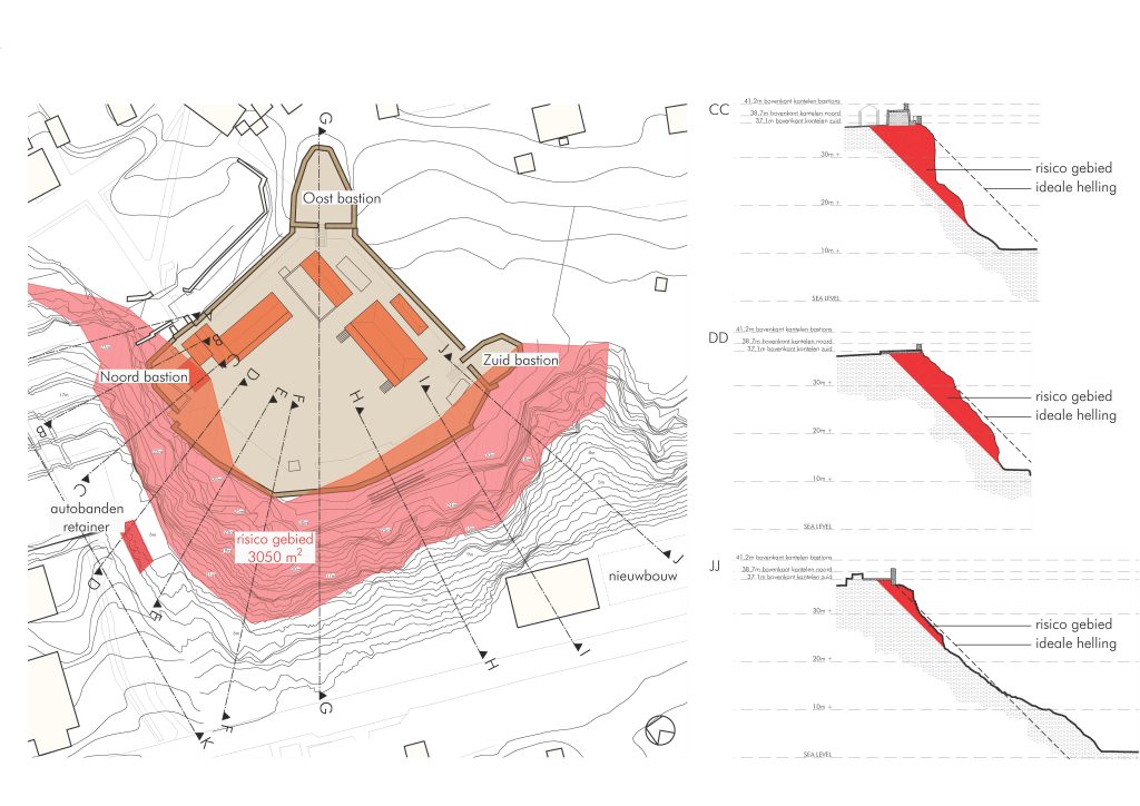
Current Condition of the Cliff at Fort Oranje, the plateau supporting Fort Oranje’s parapet was previously reinforced with a concrete slab. However, the steep cliff face below was left untreated, allowing erosion from wind and rain to continue unchecked. This process has been exacerbated by free-roaming goats, which destroy root systems that otherwise help bind the fragile cliff material.
At several locations, erosion has advanced dangerously close to the fort’s foundations. Although damage is most visible near the parapet, the entire cliff face—from base to plateau—is in poor condition. Loose, pulverized material accumulates at the foot of the cliff or is dispersed by wind and rain.
Additional Risk Factors
The island also lies within the Caribbean hurricane zone and has suffered direct hits in the past. In addition, frequent minor earthquakes, though individually limited, cumulatively place further stress on the already unstable geological foundation supporting the fort.
The most immediate threat is ongoing cliff erosion. While drainage and surface protection remain important, they are no longer sufficient on their own. The cliff’s stability—especially near the parapet foundations—has been severely compromised.
A preventive, integrated approach is therefore essential: one that addresses erosion, structural stability, climate impacts, and geological risks in a coordinated manner, while preserving the fort’s historic character.
This approach formed the basis of the advisory request of 30 September 2016. In response, we developed an integrated conservation proposal to safeguard Fort Oranje for future generations—not against human adversaries, as in the days of the Golden Rock, but against the enduring forces of nature.
With special thanks to C. P. Schipper † 06-04-2025